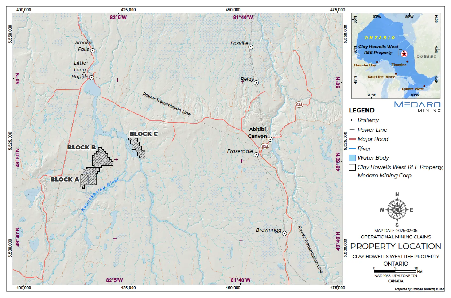
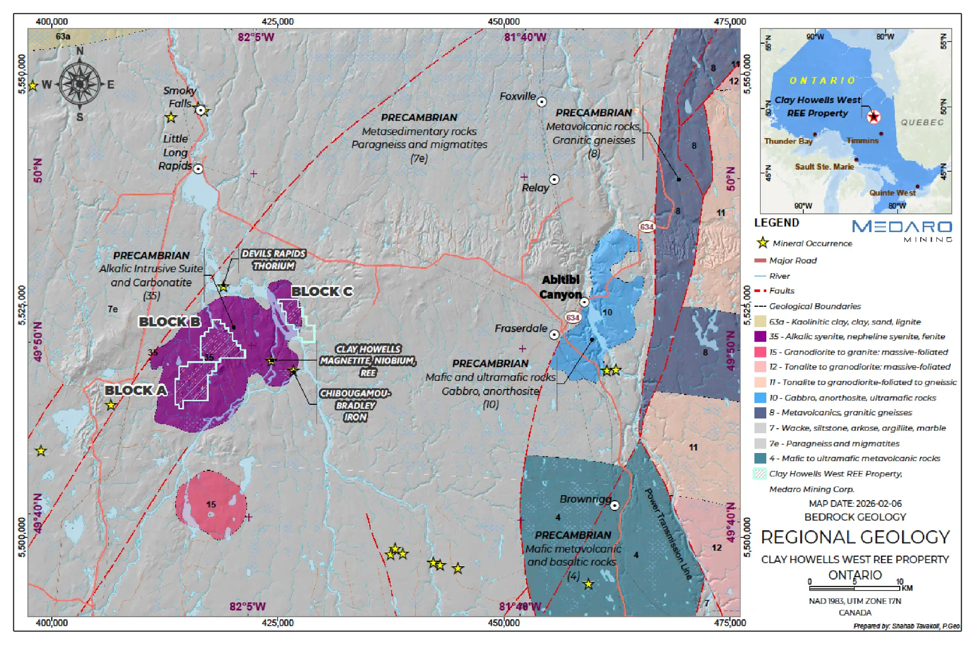
Medaro Mining acquired a large land position (13,104 Ha) within the Clay Howells alkali intrusive/carbonatite geological complex in north central Ontario, Canada.
Only 41 km from the trans Canada highway in Northern Ontario.
Within 2.9 km of a known rare earth elements (REE) deposit with REE resource (With Th & Nb)
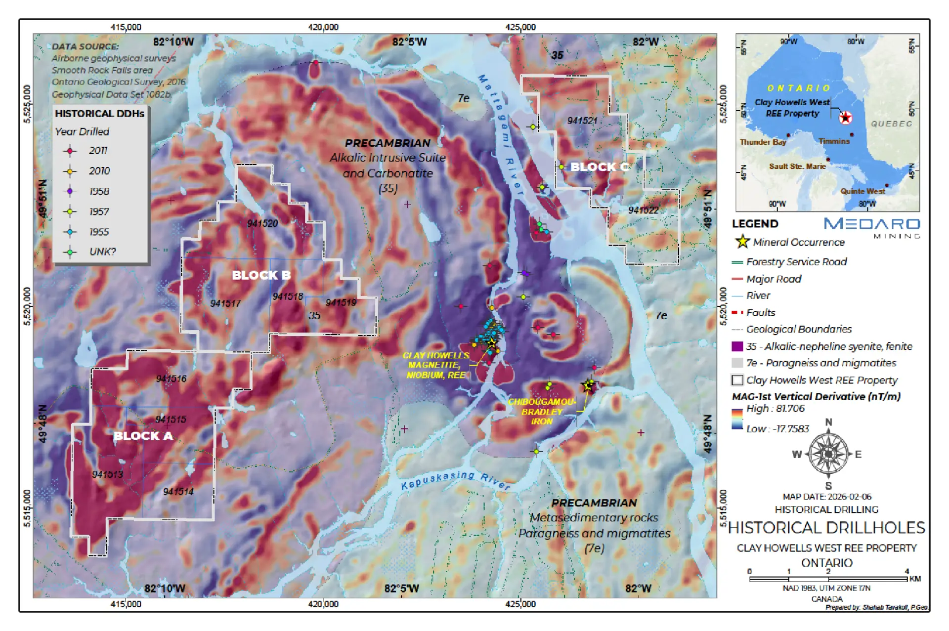
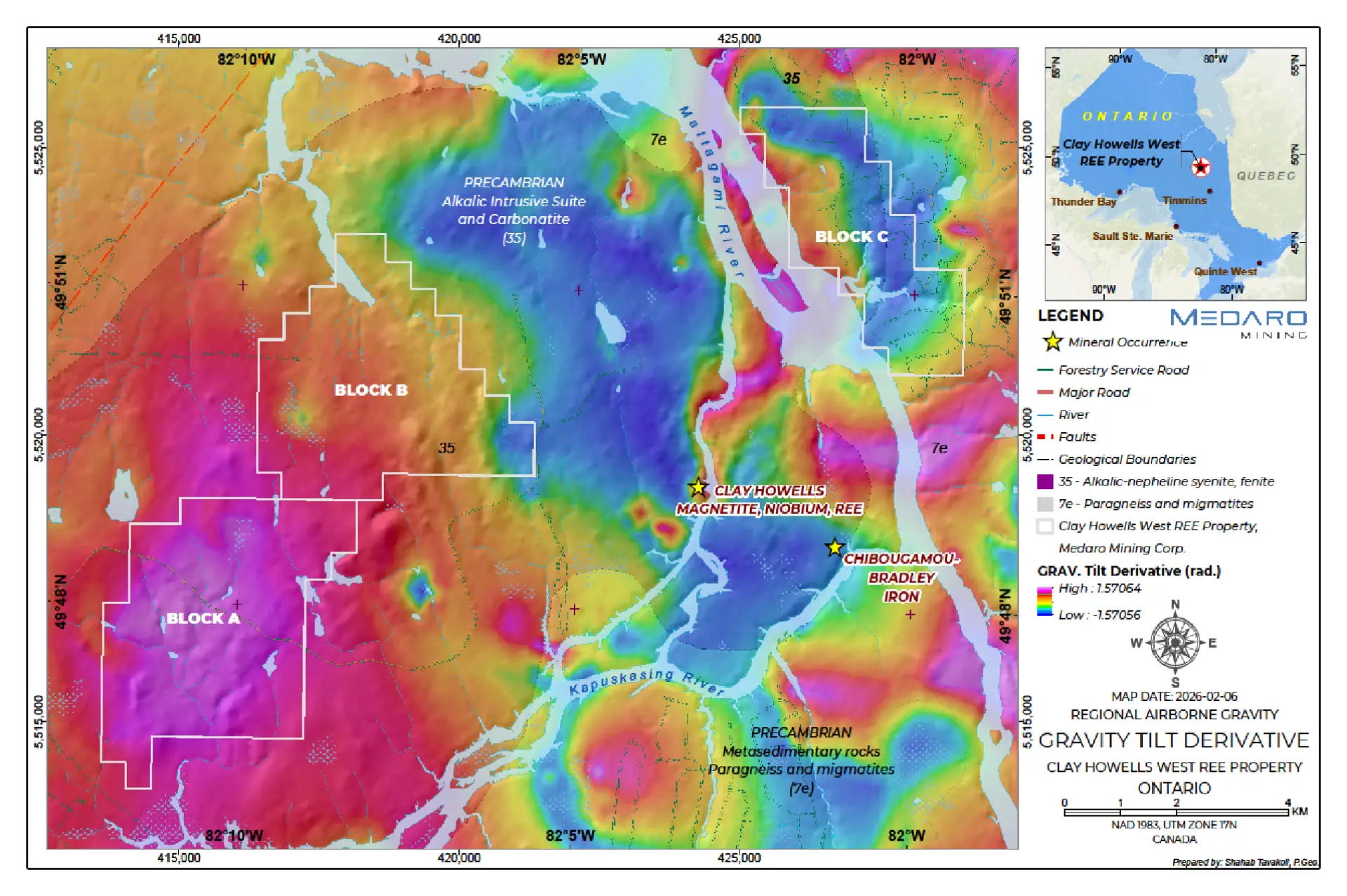
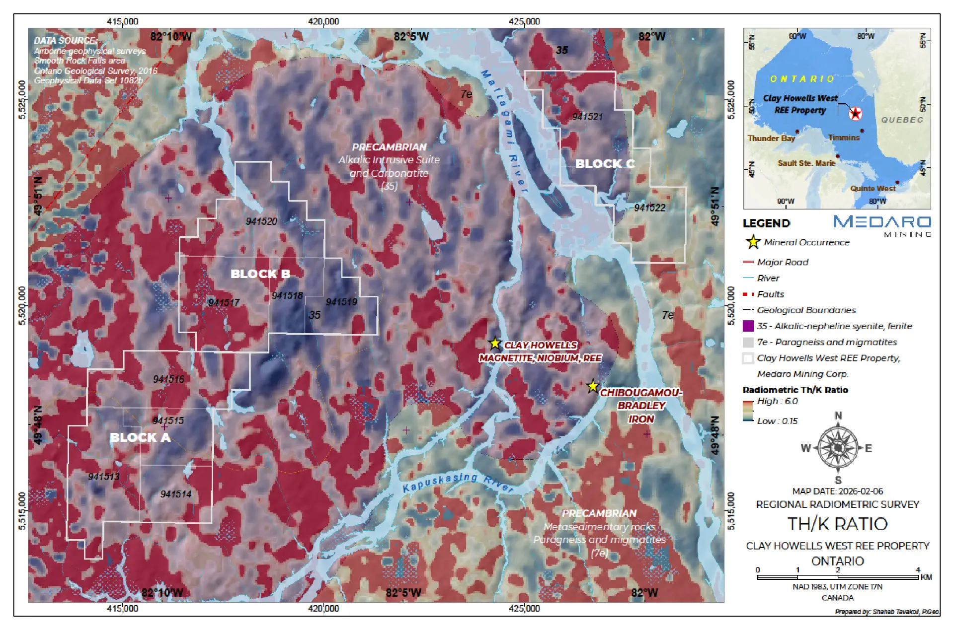
Largely unexplored but underlain by magnetic and radiogenic anomalies – part of the same complex that hosts the resource
Rare Earth prices have risen substantially since 2011 when this project was last active.
Click image to enlarge
Technical Information
The technical content of the website has been reviewed and approved by Afzaal Pirzada M.Sc., P.Geo, an independent advisor to the Company and a Qualified Person (QP) under National Instrument 43-101 – Standards of Disclosure for Mineral Projects.
The Property is located in northern Ontario, Canada, roughly 50 km north-northeast of the town of Kapuskasing.
It is defined by 56 contiguous mining claims and 45 patented claims spanning a total of 13,104 ha in 3 claim blocks (A, B, C).
Good infrastructure support.
Kapuskasing is the closest town approximately 50 kilometres to the south southwest.
Kapuskasing is a full-service community of 8500 people supporting the Forestry and Mining Industry.
Kapuskasing is situated on Highway 11 and is serviced by a natural gas pipeline, scheduled air flights and the Ontario Northland Railway.
Timmins is a city with a population of approximately 45,000 people and is accessible by roads, rail and daily air service. It is the local service centre for northeastern Ontario and has all the amenities required for the exploration and development of a mining property.
Source: Rare Earth Metals Inc. – Technical Report on the Clay-Howells 2011
Click image to enlarge
Click image to enlarge
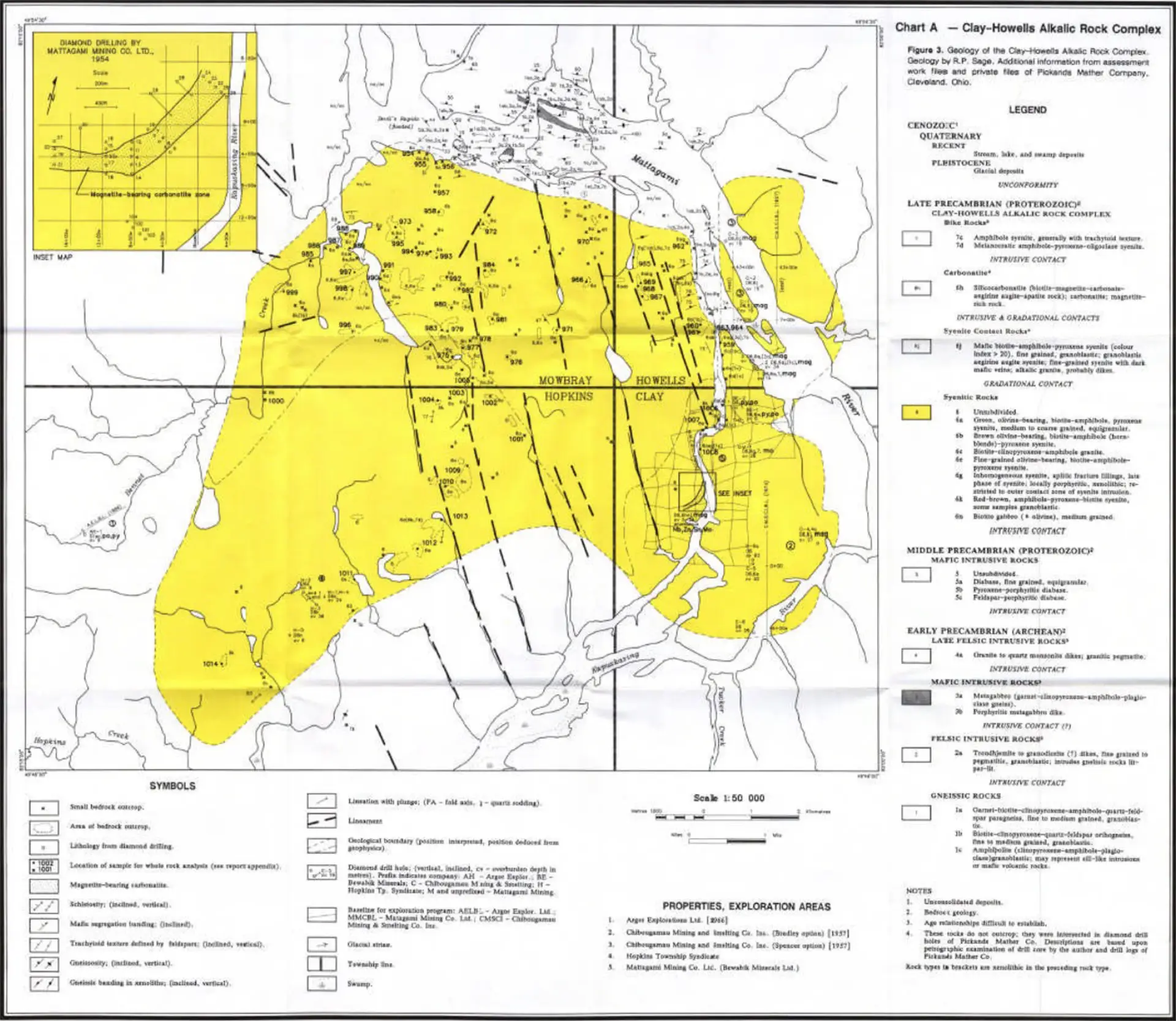
Historical Exploration
Exploration in this area is first documented in the early 1950’s with various companies evaluating magnetic anomalies either for base metals or iron ore. Most of these activities were focused on the Clay-Howells deposit located a few kilometers to the east.
Various exploration activities on the Clay-Howells Complex were completed between 1954 and 1977. This included a two-stage mapping initiative on the Clay-Howells Alkalic Rock Complex which was conducted by the Ontario Geological Survey in 1975 and 1977.
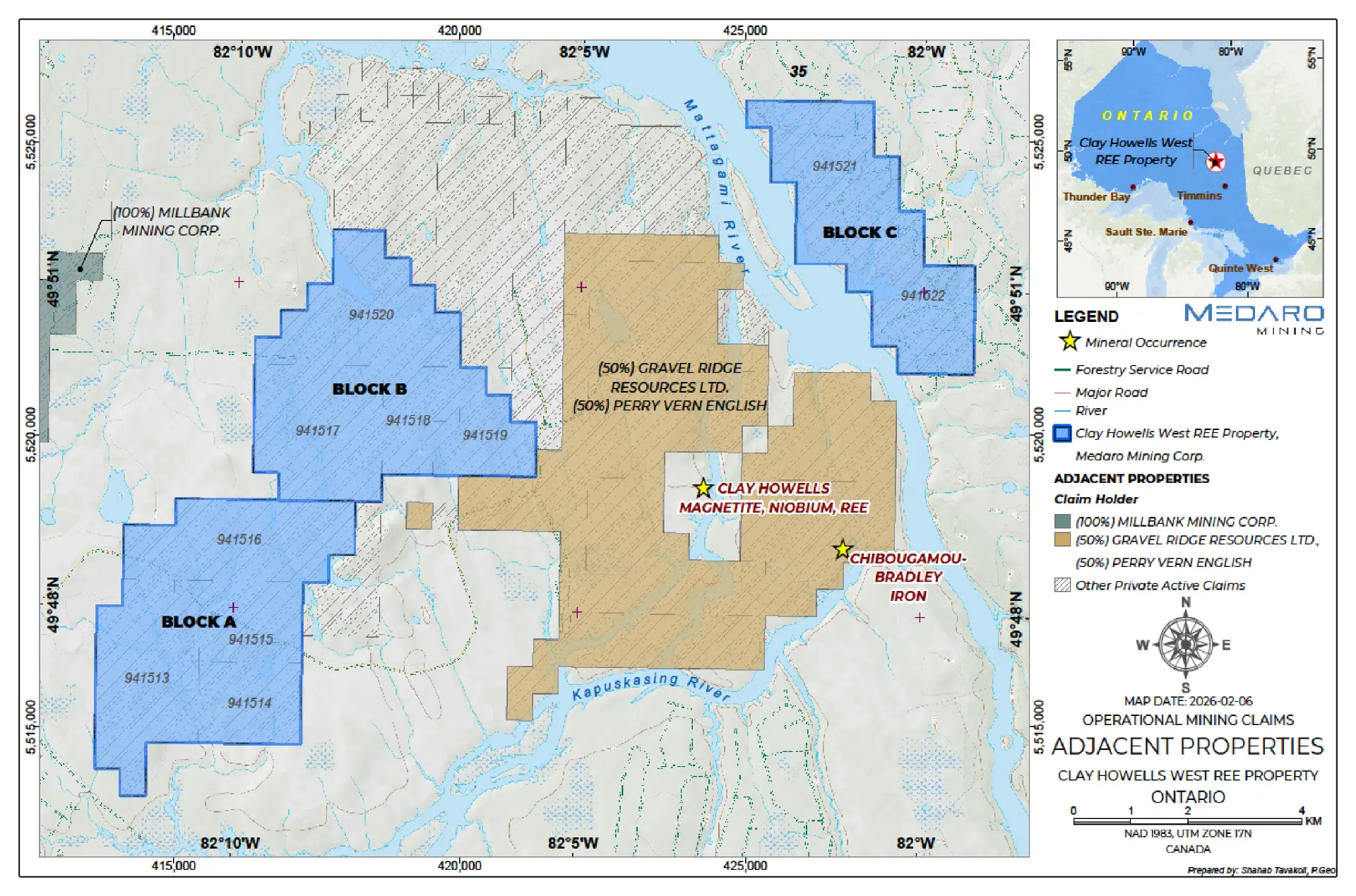
Adjacent Properties
The Property is located about 3 kilometers to the west of the Clay Howell’s REE deposit where in 2010 Rare Earth Metals Inc. drilled 18 diamond drillholes totaling 5,436.5 m. The inferred mineral resource estimate for the deposit 8.5 Mt, at a cut-off grade, 0.6 total rare earth oxide (TREO%), 44.15% iron oxide (Fe2O3%) and 0.73 TREO%.*1
*Readers are cautioned that a Qualified Person has not done sufficient work to verify mineralization and historical resource estimates on the adjacent properties and it should not be relied upon. The Company does not treat the estimate as current. Further, the information with respect to these adjacent properties is not necessarily indicative of the mineralization on the Property, which is the subject of this presentation.
Click image to enlarge
Source: Rare Earth Metals Inc. – Technical Report on the Clay-Howells 2011, effective date September 26, 2011.
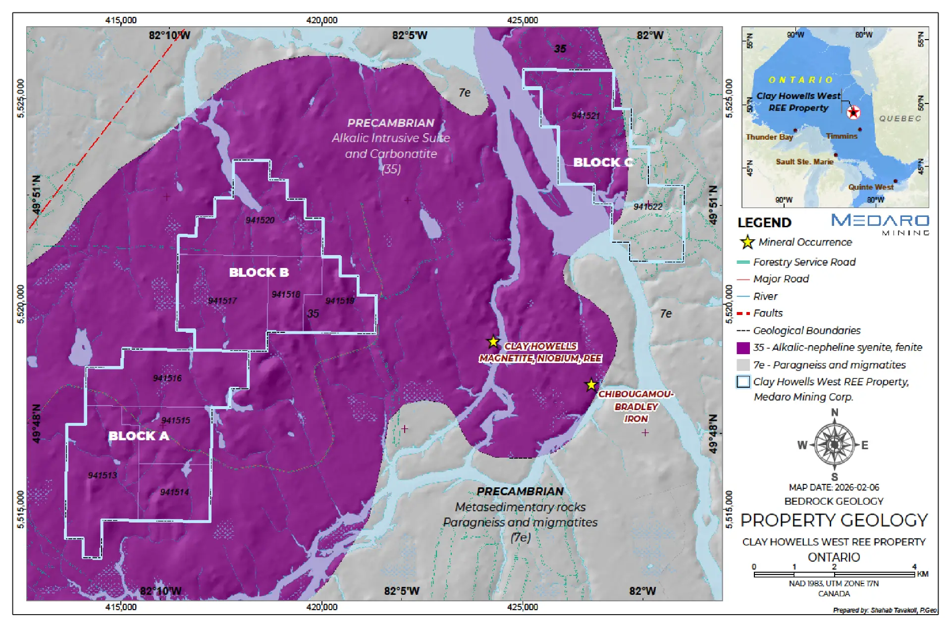
Geology and Mineralization
Click image to enlarge
The Clay-Howells Alkalic Complex is situated within the Kapuskasing Sub-province in the Canadian Shield. The syenitic to monzonitic rocks appear to have intruded the region in several pulses. They are unmetamorphosed and are thought to be mushroom-shaped in vertical cross-section. A dyke-like body of magnetite-rich carbonatite intrudes the syenitic rocks within the southeast corner of the complex.
The Property is predominantly comprised of these syenites, carbonatites, massive magnetites, fault-alteration breccias, and syenite breccias.
REE-bearing minerals identified within the Clay-Howells complex are primarily consist of a cerium- lanthanum- calcium (Ce-La-Ca) silicate and monazite. A high Fe-REE mineral, fergusonite, and allanite are also observed in trace amounts. Monazite, apatite, and a Ce-La-Ca silicate are the three main mineral groups hosting the REE. The REE-bearing minerals are typically very coarse grained with approximately 50% of the distribution occurring as grains greater than 100 μm wide (Kormos, 2010).
Source: Rare Earth Metals Inc. – Technical Report on the Clay-Howells 2011
Potential Exploration Targets*
Historical geophysical surveys and drill holes on the Clay Howells deposit to the east indicate potential to discover more mineralization on this geological complex.
Click image to enlarge
There are geological, geophysical and structural similarities with known REE mineralization analagous to the Medaro Property.
Click image to enlarge
* The potential targets are conceptual in nature; the Property is an early-stage exploration project and there has been insufficient exploration to define a mineral resource.
Click image to enlarge
Clay Howells Project Workplan
The Company is planning a two-phase exploration work program.
Phase one aims to begin exploration in the spring/summer of 2026 with results to follow and is proposed to include:
Desktop study to compile historical information;
Airborne and ground geophysical surveys (radiometric, magnetic and VLF); and
Ground prospecting, geological mapping, and sampling.
Contingent upon favourable phase one results, phase two work will include trenching and diamond drilling.