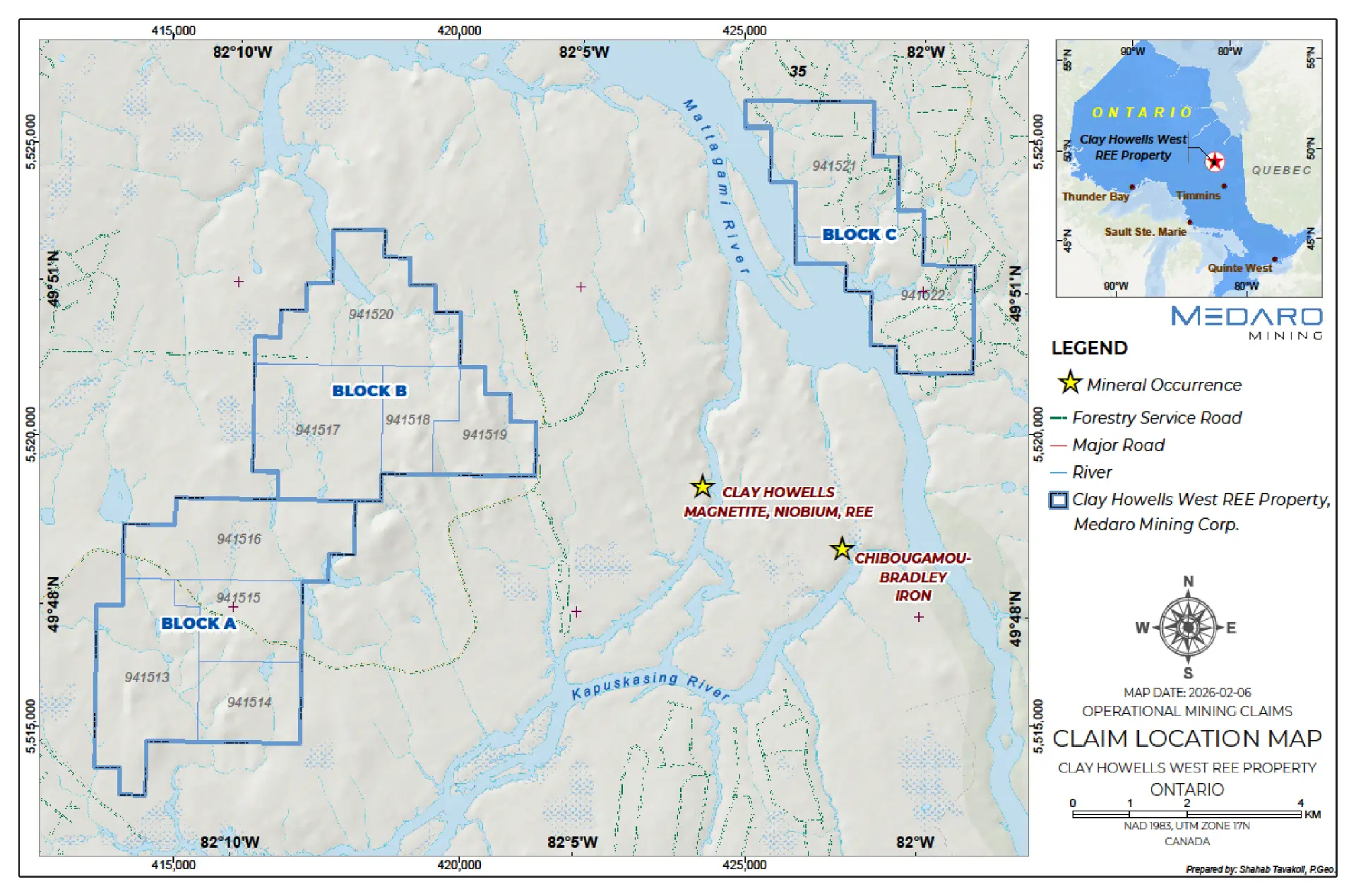
Strategic land position: Medaro holds an option to acquire a 100% interest in a multi-block property covering approximately 3,916 ha in northern Ontario.
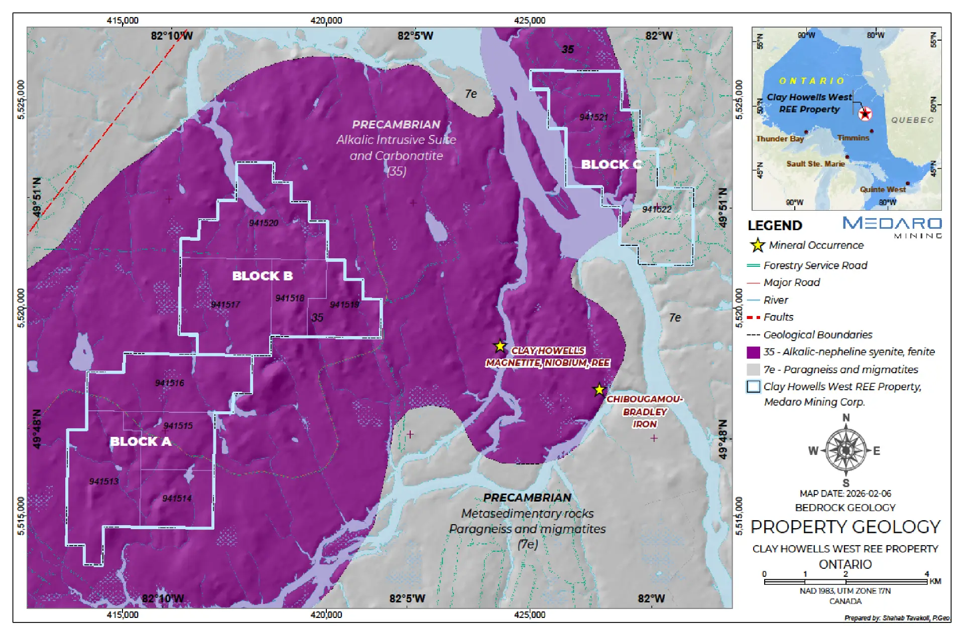
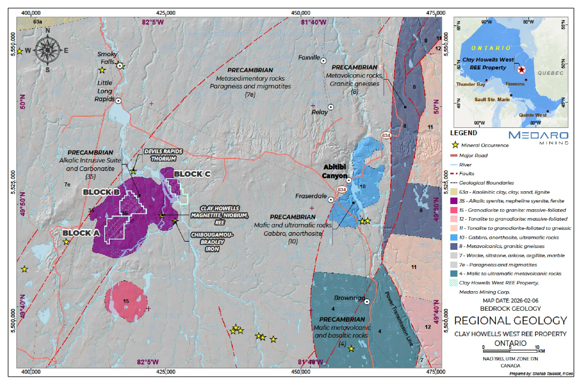
Prospective geological setting: The property lies within the 110 km² Clay-Howells alkalic intrusive–carbonatite complex, a geological environment prospective for rare earth element (REE) mineralization.
Adjacent mineralization provides geological context: The property is located approximately 2.9 km west of the historic Clay-Howells REE–niobium–magnetite deposit.
Underexplored target area: Historical regional magnetic and radiometric datasets identify anomalies across the broader complex, whilst historic exploration has principally focused on the adjacent deposit.
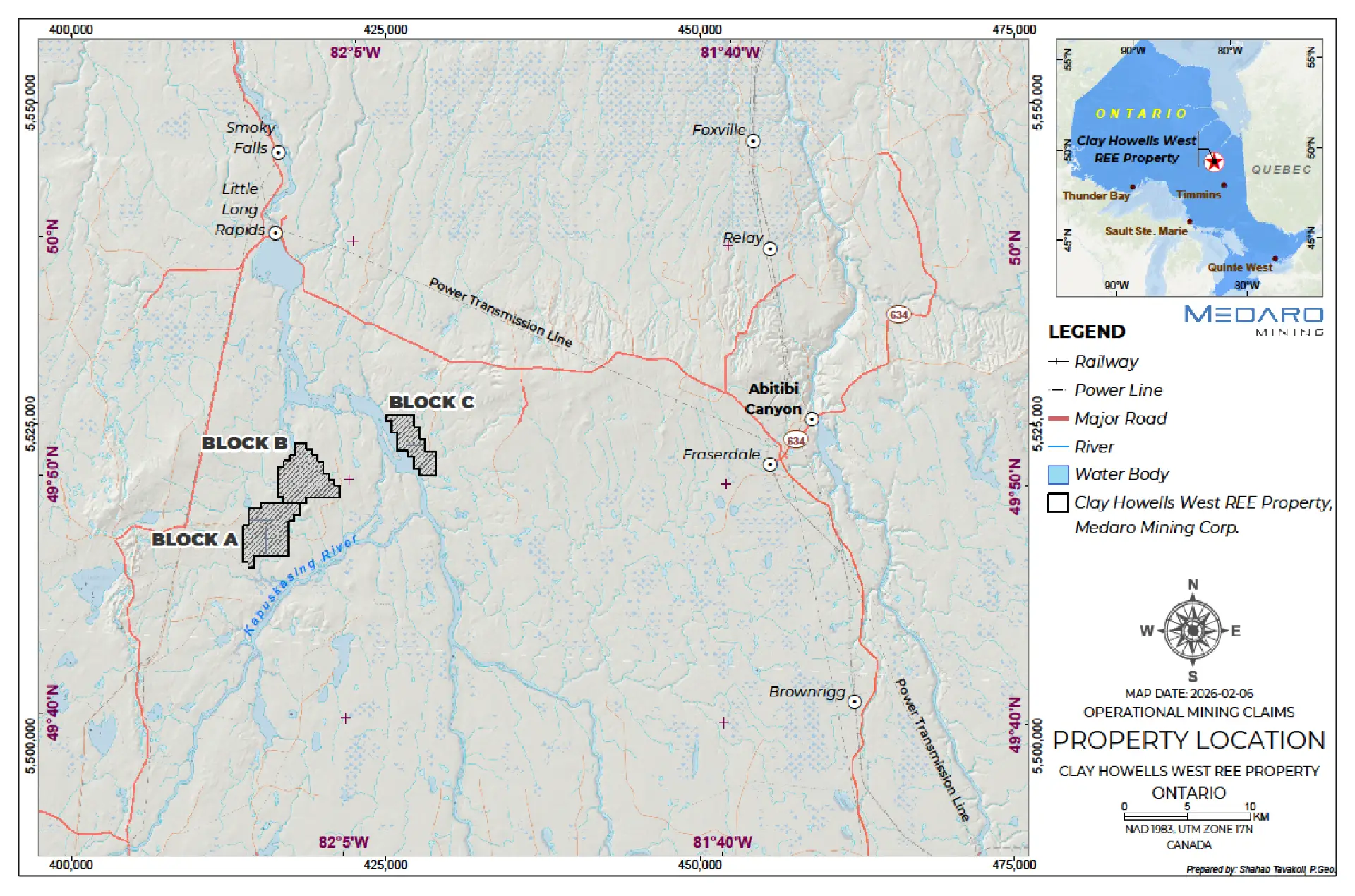
Accessible Canadian jurisdiction: The property is located approximately 50 km north-northeast of Kapuskasing and 41 km from the Trans-Canada Highway, with access to established regional services and infrastructure.
Clear path to ownership: Medaro can earn a 100% interest in the property, subject to the underlying option terms and royalty.
Click image to enlarge
Technical Information
The technical content of the website has been reviewed and approved by Afzaal Pirzada M.Sc., P.Geo, an independent advisor to the Company and a Qualified Person (QP) under National Instrument 43-101 – Standards of Disclosure for Mineral Projects.
Co-product potential (niobium, iron & thorium (Nb – Fe-Th))
Infrastructure advantage
Comparable global analogs
Location and Infrastructure
The Property is located in northern Ontario, Canada, roughly 50 km north-northeast of the town of Kapuskasing.
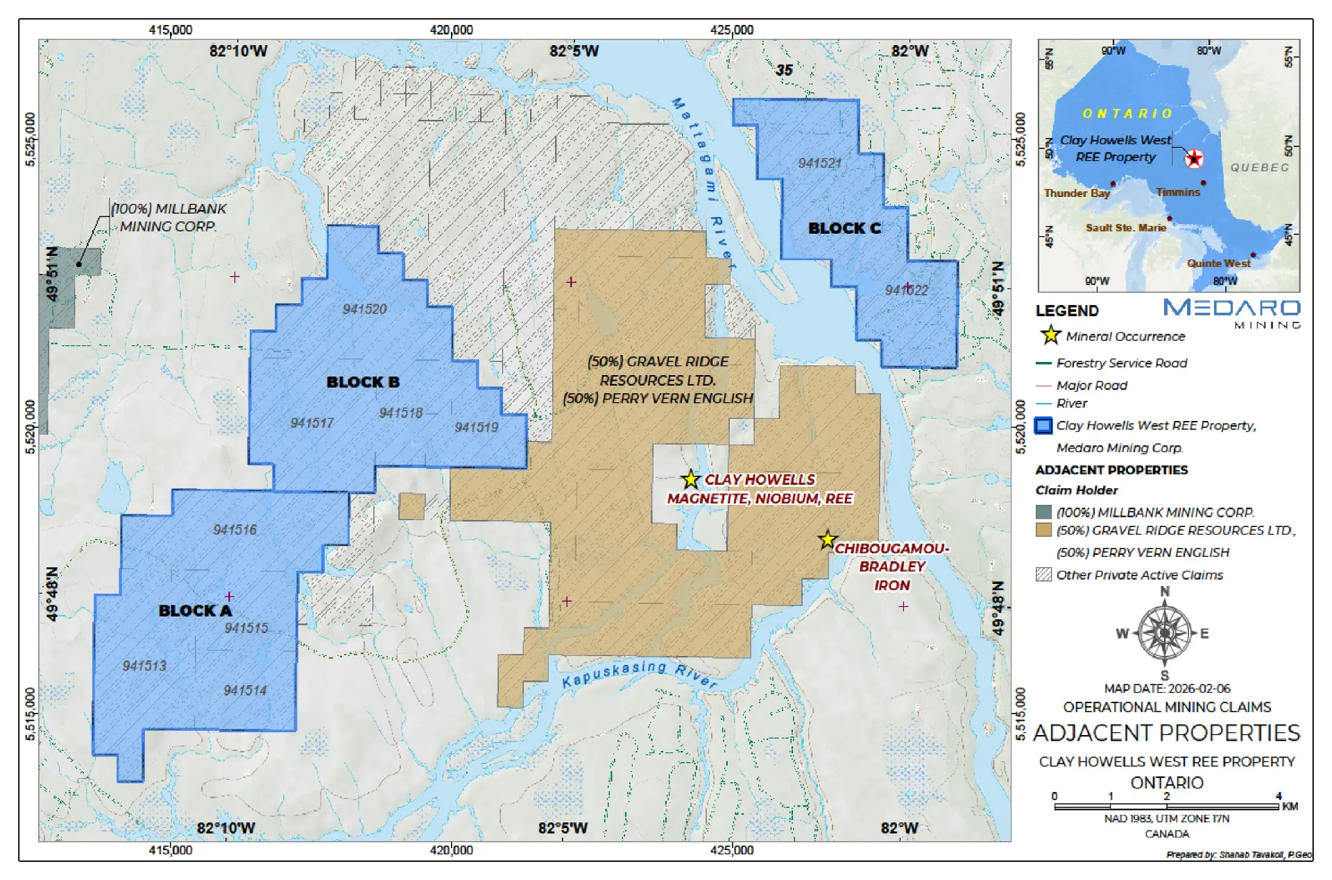
It is defined by 56 contiguous mining claims and 45 patented claims spanning a total of 13,104 ha in 3 claim blocks (A, B, C).
Good infrastructure support.
Kapuskasing, approximately 50 km south-southwest, is a full-service community of 8,500 people supporting the forestry and mining industries, with access to Highway 11, natural gas, scheduled air service and the Ontario Northland Railway.
Timmins, with a population of approximately 45,000, is a regional service centre for northeastern Ontario, offering road, rail and daily air access and the infrastructure and amenities required to support mineral exploration and mine development.
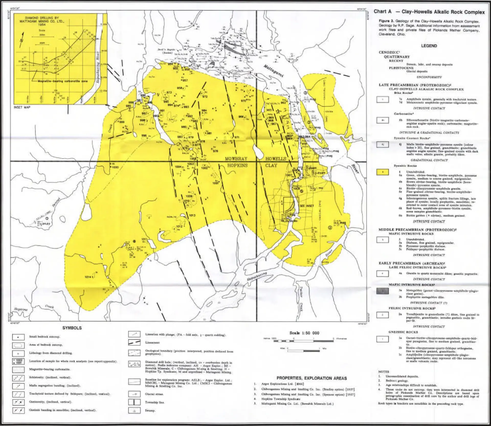
Source: Rare Earth Metals Inc. – Technical Report on the Clay-Howells 2011
Click image to enlarge
Click image to enlarge
Historical Exploration
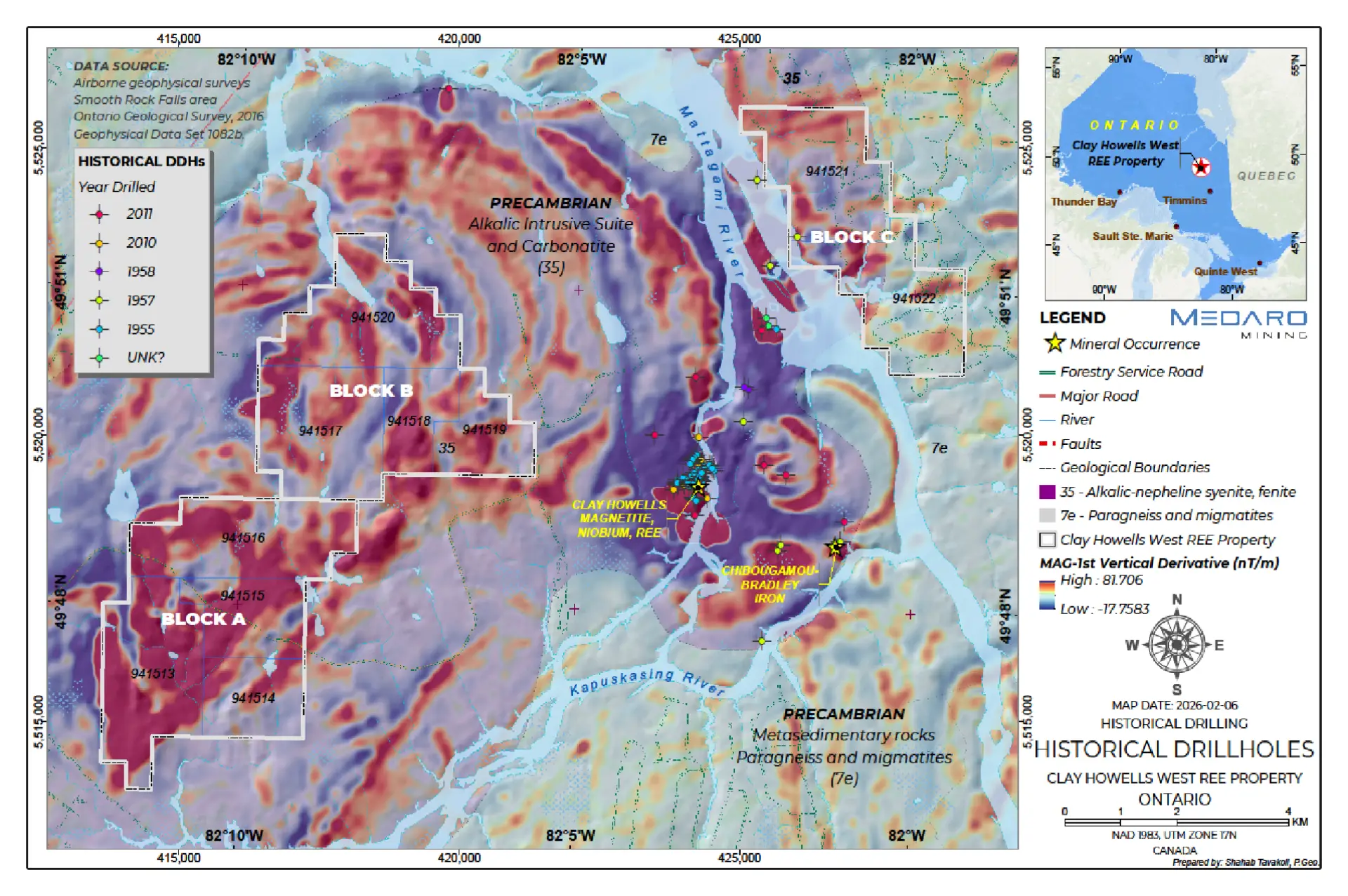
Exploration in this area is first documented in the early 1950’s with various companies evaluating magnetic anomalies either for base metals or iron ore. Most of these activities were focused on the Clay-Howells deposit located a few kilometers to the east.
Various exploration activities on the Clay-Howells Complex were completed between 1954 and 1977. This included a two-stage mapping initiative on the Clay-Howells Alkalic Rock Complex which was conducted by the Ontario Geological Survey in 1975 and 1977.
Adjacent Properties
The Property is located about 3 kilometers to the west of the Clay Howell’s REE deposit where in 2010 Rare Earth Metals Inc. drilled 18 diamond drillholes totaling 5,436.5 m. The inferred mineral resource estimate for the deposit 8.5 Mt, at a cut-off grade, 0.6 total rare earth oxide (TREO%), 44.15% iron oxide (Fe2O3%) and 0.73 TREO%.*1
*Readers are cautioned that a Qualified Person has not done sufficient work to verify mineralization and historical resource estimates on the adjacent properties and it should not be relied upon. The Company does not treat the estimate as current. Further, the information with respect to these adjacent properties is not necessarily indicative of the mineralization on the Property, which is the subject of this presentation.
Click image to enlarge
Source: Rare Earth Metals Inc. – Technical Report on the Clay-Howells 2011, effective date September 26, 2011.
Geology and Mineralization
Click image to enlarge
The Clay Howells Alkalic Complex is situated within the Kapuskasing Sub-province in the Canadian Shield. The syenitic to monzonitic rocks appear to have intruded the region in several pulses. They are unmetamorphosed and are thought to be mushroom-shaped in vertical cross-section. A dyke-like body of magnetite-rich carbonatite intrudes the syenitic rocks within the southeast corner of the complex.
The Property is predominantly comprised of these syenites, carbonatites, massive magnetites, fault-alteration breccias, and syenite breccias.
REE-bearing minerals identified within the Clay Howells complex are primarily consist of a cerium- lanthanum- calcium (Ce-La-Ca) silicate and monazite. A high iron (Fe)-REE mineral, fergusonite, and allanite are also observed in trace amounts. Monazite, apatite, and a Ce-La-Ca silicate are the three main mineral groups hosting the REE. The REE-bearing minerals are typically very coarse grained, with approximately 50% of the distribution occurring as grains greater than 100 μm wide (Kormos, 2010).
Source: Rare Earth Metals Inc. – Technical Report on the Clay-Howells 2011
Potential Exploration Targets*
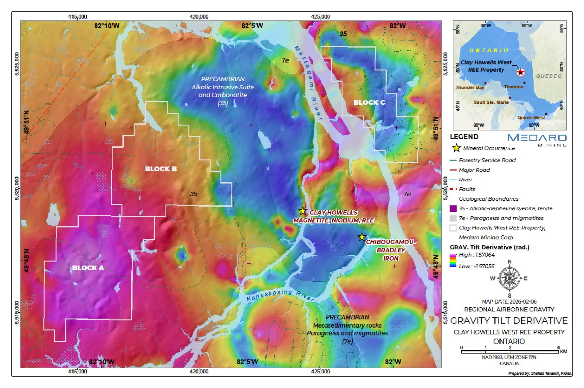
Historical geophysical surveys and drill holes on the Clay Howells deposit to the east indicate potential to discover more mineralization on this geological complex.
Click image to enlarge
There are geological, geophysical and structural similarities with known REE mineralization analogous to the Medaro Property.
Click image to enlarge
* The potential targets are conceptual in nature; the Property is an early-stage exploration project and there has been insufficient exploration to define a mineral resource.
Click image to enlarge
Clay Howells Project Workplan
The Company has completed the compilation and review of historical exploration data, including geological, geophysical, drilling and sampling information.
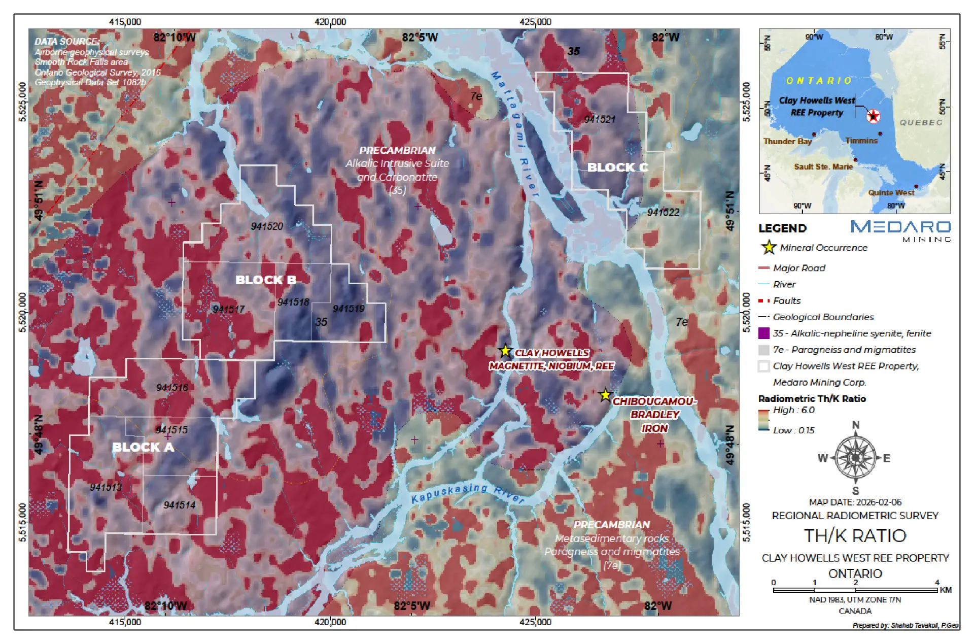
Initial work has identified prospective REE targets supported by historical data, magnetic and radiometric anomalies, and the Property’s geological setting.
The Company is advancing field prospecting, geological mapping and systematic sampling to further refine and prioritize these targets.
Phase II will focus on trenching and diamond drilling of priority targets identified through the exploration program.
The objective is to test REE mineralization, evaluate extensions of known mineralization and identify new discoveries across the Property.
PHASE 1 COMPLETE
AN INTEGRATED DATASET TO DRIVE TARGET SELECTION
2026 Exploration Program
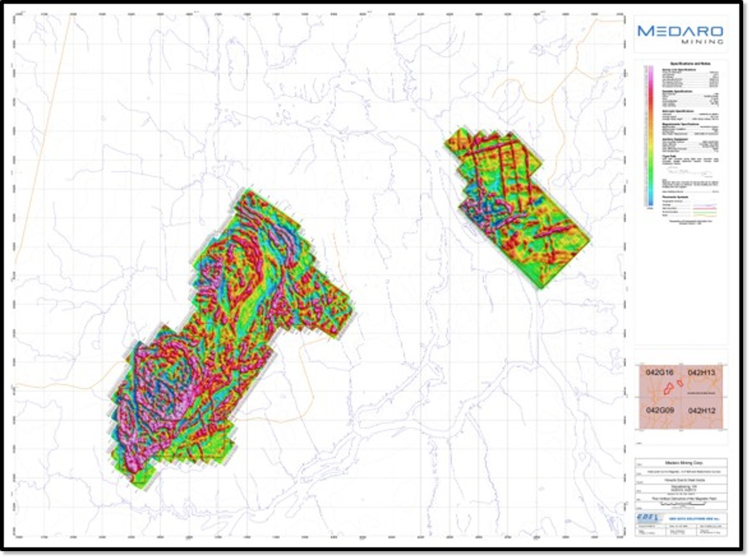
High-resolution geophysics completed1: Medaro has completed 1,143 line-km of helicopter-borne magnetic, radiometric and VLF-EM surveying across the Clay Howells West project blocks.
Detailed survey coverage: Data were acquired on approximately 50 m traverse lines with 350 m tie-line spacing and an average terrain clearance of approximately 36 m.
Ground program completed: Geological mapping, prospecting and ground radiometric surveying have been undertaken across priority target areas.
Samples submitted for analysis: A total of 61 rock samples and 45 soil samples have been submitted to an accredited laboratory for multi-element analysis, including rare earth elements.
Initial field observations: Several rock samples returned elevated scintillometer responses, including one locally elevated reading of 750–950 cps. These are preliminary field measurements and are not assays or direct measurements of REE concentrations.
Next decision point: Integrate the geophysical, geological, radiometric and laboratory datasets to rank targets and determine whether follow-up sampling, trenching or initial drilling is warranted.
Airborne survey map – first vertical derivative of the magnetic field Click image to enlarge